
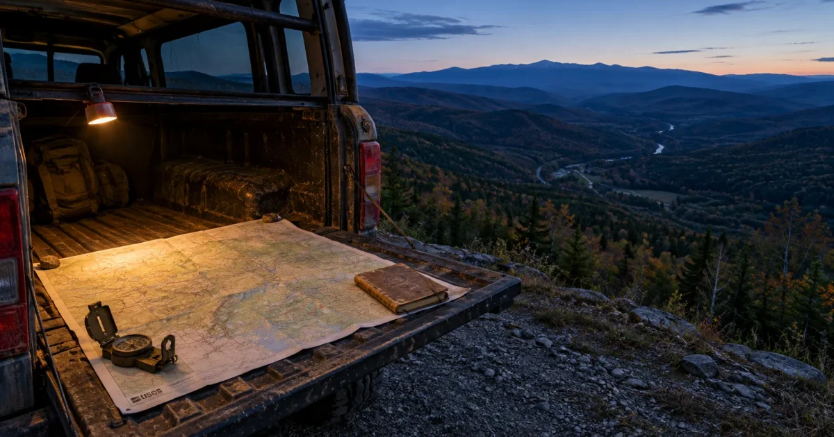
Where you live heavily shapes your odds of surviving a major conflict on American soil. Understanding which regions carry the greatest risk helps you prepare your household without wasting money on panic purchases.
A direct military exchange would focus on strategic infrastructure, command networks, and nuclear launch sites. Living near these assets puts you directly in the crosshairs of an adversary’s first strike.
Meanwhile, remote communities far from military installations offer distinct advantages, though true safety involves more than geographic isolation. Here is a realistic look at the safest and most dangerous places in America during wartime.
The “Nuclear Sponge”: Why the Great Plains Face Maximum Risk
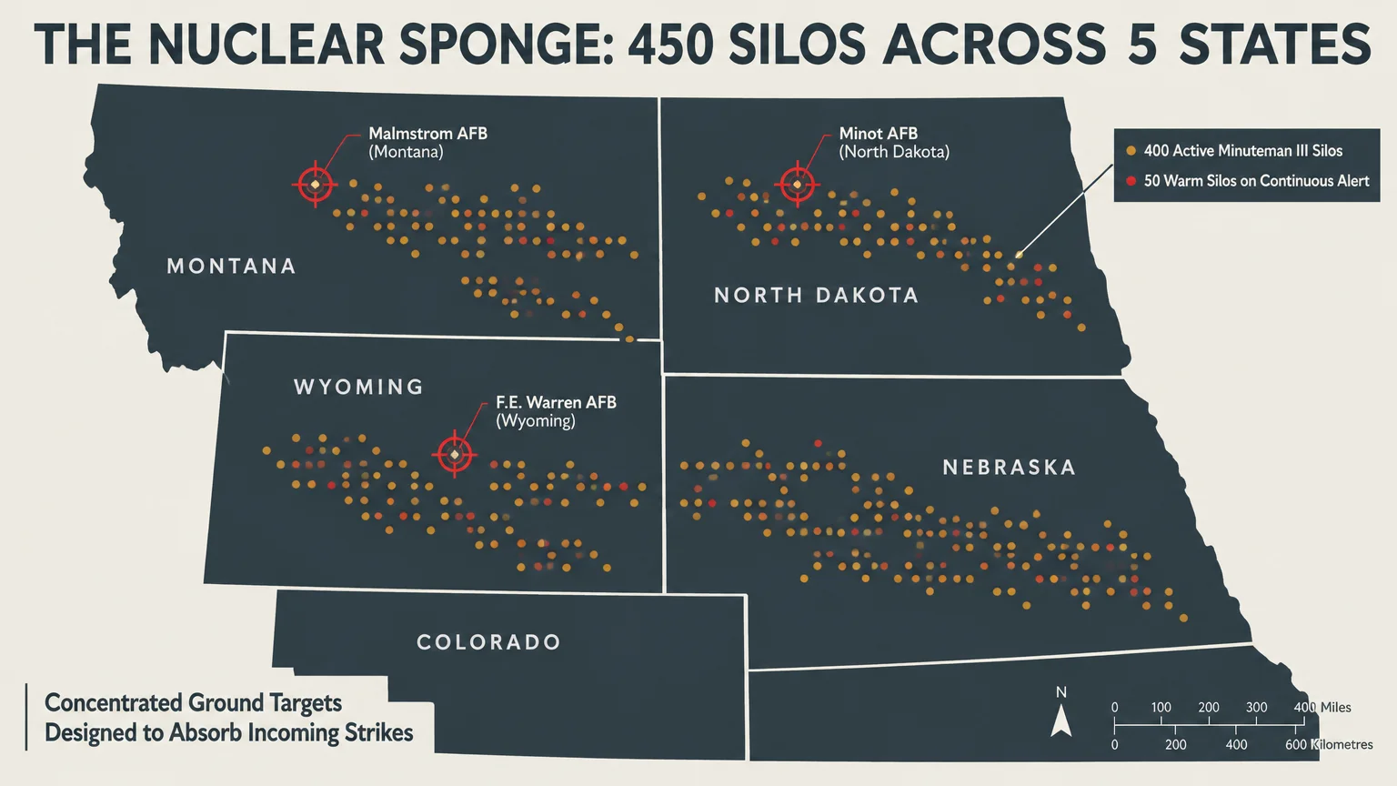
The United States maintains 400 active Minuteman III intercontinental ballistic missiles on continuous alert. Military planners disperse these weapons across 450 underground silos, keeping 50 empty but warm for operational flexibility.
These silos sit across five rural states: Montana, North Dakota, Wyoming, Colorado, and Nebraska. Because these missiles can launch within minutes, any adversary seeking to disarm the United States must target them immediately.
Defense analysts refer to these sprawling missile fields as the nation’s “nuclear sponge.” The Department of Defense intentionally positioned them across sparsely populated areas to absorb incoming warheads away from coastal cities.
Three specific Air Force bases oversee these fields. F.E. Warren Air Force Base in Wyoming, Malmstrom Air Force Base in Montana, and Minot Air Force Base in North Dakota control every active silo.
Living downwind or within commuting distance of these bases exposes you to severe danger. An enemy would direct hundreds of high-yield nuclear warheads at these locations during the opening minutes of a conflict.
The resulting ground bursts would produce catastrophic local destruction. They would also lift millions of tons of vaporized earth into the upper atmosphere, creating lethal plumes of radioactive dust.
America’s Most Dangerous Strategic and Command Targets
Missile silos represent only one component of America’s defensive triad. Adversaries must also neutralize the nation’s nuclear-capable submarines, long-range strategic bombers, and senior military leaders to prevent counterattacks.
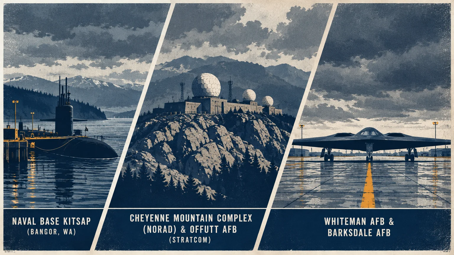
Ballistic missile submarines carry the bulk of the nation’s deployed, survivable nuclear arsenal. The Navy berths these vessels at just two primary locations on opposite coasts.
Naval Base Kitsap, located at Bangor on Washington’s Puget Sound, hosts the Pacific submarine fleet. On the Atlantic coast, Naval Submarine Base Kings Bay in Camden County, Georgia, houses the Atlantic fleet.
Both submarine installations rank among the highest-priority military targets on Earth. Surrounding civilian areas, including suburban Seattle and coastal Georgia, face catastrophic blast and heat effects during a major confrontation.
Strategic bomber bases face similar threats. Whiteman Air Force Base in Johnson County, rural Missouri, houses the nation’s entire operational fleet of B-2 Spirit stealth bombers.
Barksdale Air Force Base in Bossier Parish, Louisiana, commands the Air Force Global Strike Command and fleets of B-52 bombers. Both locations would attract immediate, heavy salvos during an escalating conflict.
Command infrastructure faces equal peril. Offutt Air Force Base, situated south of Omaha, Nebraska, hosts U.S. Strategic Command, which directs all national nuclear operations.
In Colorado Springs, Colorado, the Cheyenne Mountain Complex provides hardened aerospace defense tracking for NORAD. The concentration of military facilities in El Paso County makes the region exceptionally vulnerable.
Civilian leadership hubs carry extreme target profiles. Washington, D.C., the Pentagon in Arlington, Virginia, and regional government continuity shelters would face direct bombardment to sever national decision-making.
Major economic arteries also feature prominently on targeting maps. The Port of Houston handles critical petrochemical refining, while New York City anchors global financial infrastructure, making both prime targets for conventional or unconventional destruction.
Nuclear Fallout Patterns and Prevailing Wind Dangers
Geographic safety involves more than avoiding ground zero. Atmospheric physics and prevailing meteorological patterns dictate where radioactive fallout travels after ground detonations occur.
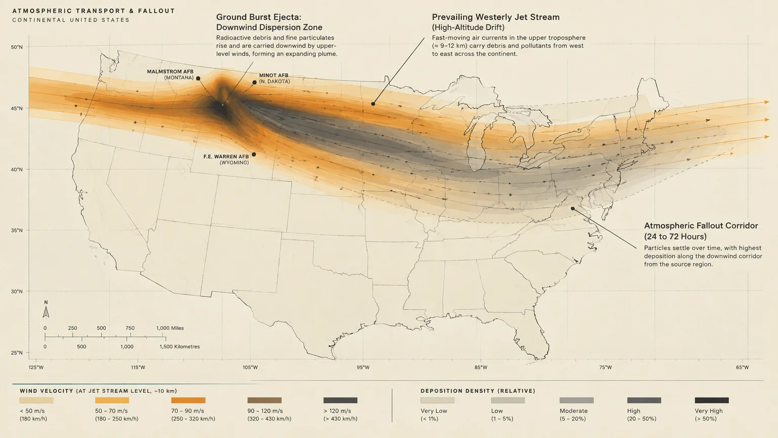
The jet stream over North America flows predominantly from west to east. When nuclear warheads detonate against reinforced missile silos in Montana, Wyoming, and North Dakota, prevailing winds push fallout eastward.
Dense plumes of radioactive particles would drift over major Midwestern population corridors. Research models indicate that fallout from the Great Plains silos could sweep across Minnesota, Iowa, Illinois, Wisconsin, and the Ohio River Valley.
These particles emit penetrating gamma radiation during their initial decay period. Being 500 miles away from an explosion offers zero protection if the upper winds steer the particulate cloud directly over your town.
According to research models evaluated by defense equipment organizations like MIRA Safety, regions situated directly upwind or far south of missile tracks face dramatically lower fallout deposition.
Understanding regional wind patterns allows you to evaluate your true risk. Proximity to a target matters, but downwind trajectory often dictates whether an area remains survivable after an attack.

The Safest States and Regions During Wartime
While no location offers absolute immunity from international conflict, several American regions feature distinct geographical advantages. These areas lack high-value military installations, stand upwind of major silos, and feature low population density.
Northern Maine represents one of the safest geographic zones in the continental United States. The region sits far northeast of the Midwest fallout path and contains no active strategic nuclear infrastructure.
Maine also provides abundant natural freshwater, vast timber resources, and a sparse population. These factors dramatically increase your resilience if national distribution networks collapse.
Western Texas provides another viable refuge. Positioned far south of the central missile fields, the region stays clear of northern and midwestern fallout trajectories.
While western Texas features arid conditions requiring careful water planning, it lacks primary strategic military targets outside specific localized border infrastructure. Its distance from major urban centers buffers residents from secondary civil unrest.
Large rural expanses of Nevada and southeastern Oregon offer natural protection through terrain. Mountainous basin-and-range topography disrupts fallout distribution, while low population density minimizes competition for basic resources.
Northern California, specifically the rural counties well north of Sacramento and the Bay Area, avoids major strategic targets. The Pacific weather systems push clean oceanic air inland across the coastal ranges.
Parts of Michigan’s Upper Peninsula and northern Wisconsin also enjoy favorable geography. Placed north of primary downwind corridors from North Dakota, these areas provide immense freshwater access through the Great Lakes basin.
The primary danger during a nuclear conflict is not just the initial fireball, but the societal collapse that follows. Regions with clean water, low population density, and no strategic military assets provide the best odds for long-term survival.
These rural pockets allow families to avoid immediate blast waves and acute fallout. However, physical survival still requires careful preparation for systemic economic paralysis.
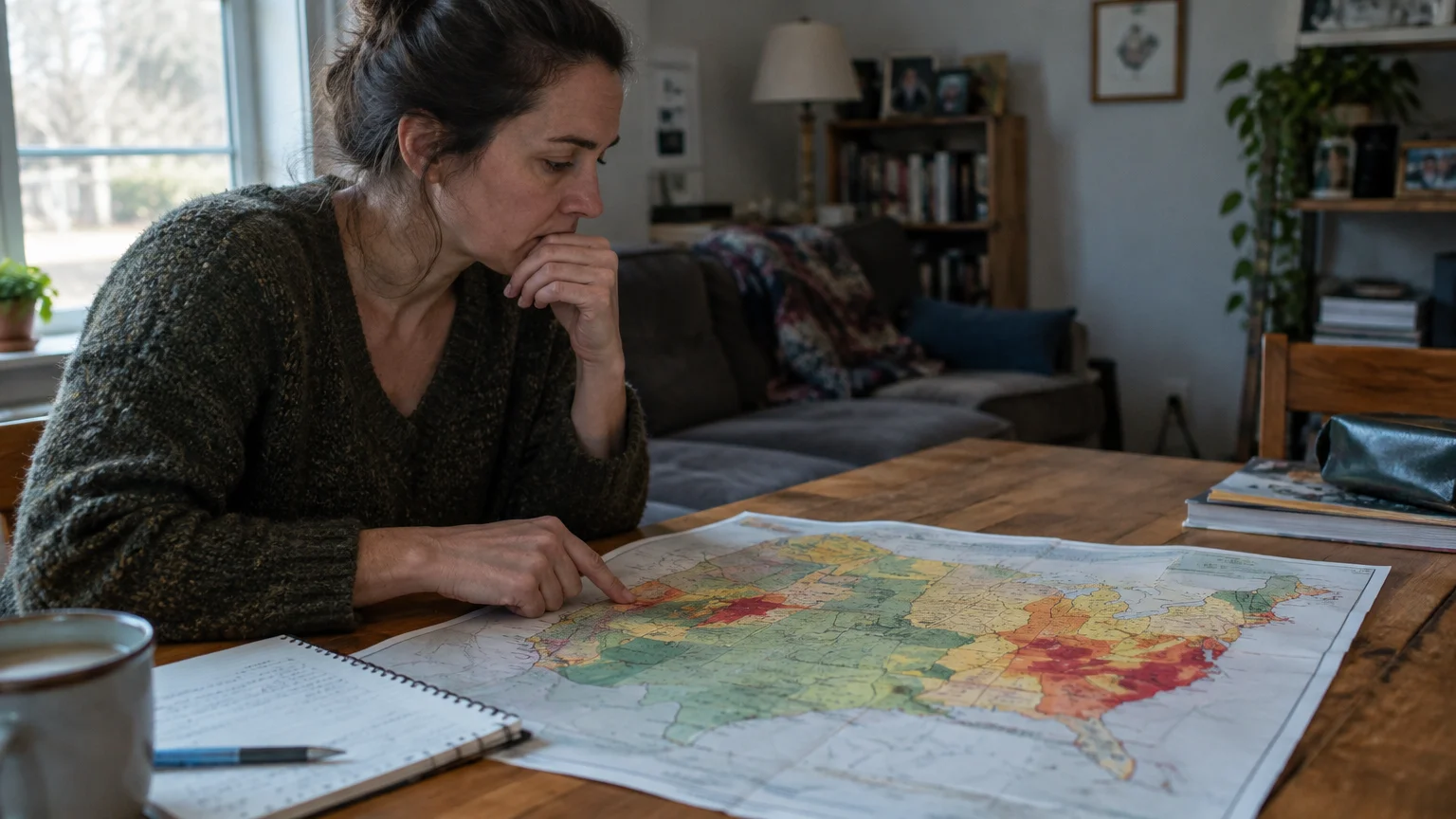
Regional Risk Comparison: Safest vs. Most Dangerous Zones
Evaluating regional safety requires weighing strategic military value against geographic vulnerabilities. The following comparison outlines the primary threat profiles across different sections of the country.
| Region / Zone | Risk Classification | Primary Threat Drivers | Key Strategic Targets | Fallout Vulnerability |
|---|---|---|---|---|
| Great Plains (MT, ND, WY, CO, NE) | Extreme Risk | Active Minuteman III ICBM silos and missile command wings. | Malmstrom AFB, Minot AFB, F.E. Warren AFB, Offutt AFB. | Extreme; massive localized ground bursts and intense eastward plume generation. |
| Puget Sound & Coastal Georgia | Extreme Risk | Ballistic missile submarine bases harboring Ohio-class vessels. | Naval Base Kitsap (WA), Naval Submarine Base Kings Bay (GA). | High to Moderate; heavy coastal blasts with localized fallout spreading inland. |
| Mid-Atlantic & Major Metros | High Risk | Political leadership, national defense commands, financial centers. | Washington, D.C., The Pentagon, New York City, Port of Houston. | Severe; blast damage combined with rapid infrastructure and utility collapse. |
| Midwestern Farm Belt (IL, IN, OH) | Moderate to High Risk | Secondary fallout drift from Great Plains missile silo strikes. | Regional transport hubs, electrical substations, fuel distribution depots. | High; heavy downwind fallout exposure along prevailing jet stream paths. |
| Northern New England (Northern ME, VT, NH) | Low Risk | Absence of strategic military bases and favorable northern wind vectors. | None; strictly regional infrastructure and minor transportation routes. | Very Low; sits north and east of main continental fallout trajectories. |
| Intermountain West & Western TX | Low Risk | Sparse population density and geographic isolation from primary targets. | None; vast tracts of open public land and agricultural expanses. | Low; positioned outside direct downwind paths of northern missile fields. |

Why People Are Talking About This
Geopolitical stability has degraded significantly over recent years. Expanding conflicts in Eastern Europe and the Middle East have pushed military preparedness back into mainstream public discussion.
Modern military doctrines increasingly emphasize hypersonic missiles, cyber warfare, and tactical nuclear options. These developments shorten response times and heighten the risk of miscalculation between superpowers.
Americans also recognize the fragility of modern critical infrastructure. Coordinated cyberattacks against power grids, financial exchanges, or fuel pipelines could paralyze cities within hours, even without nuclear weapons.
Consequently, families across every income bracket are reassessing where they live. Practical self-reliance has transitioned from a fringe hobby into a sensible household financial and logistical priority.
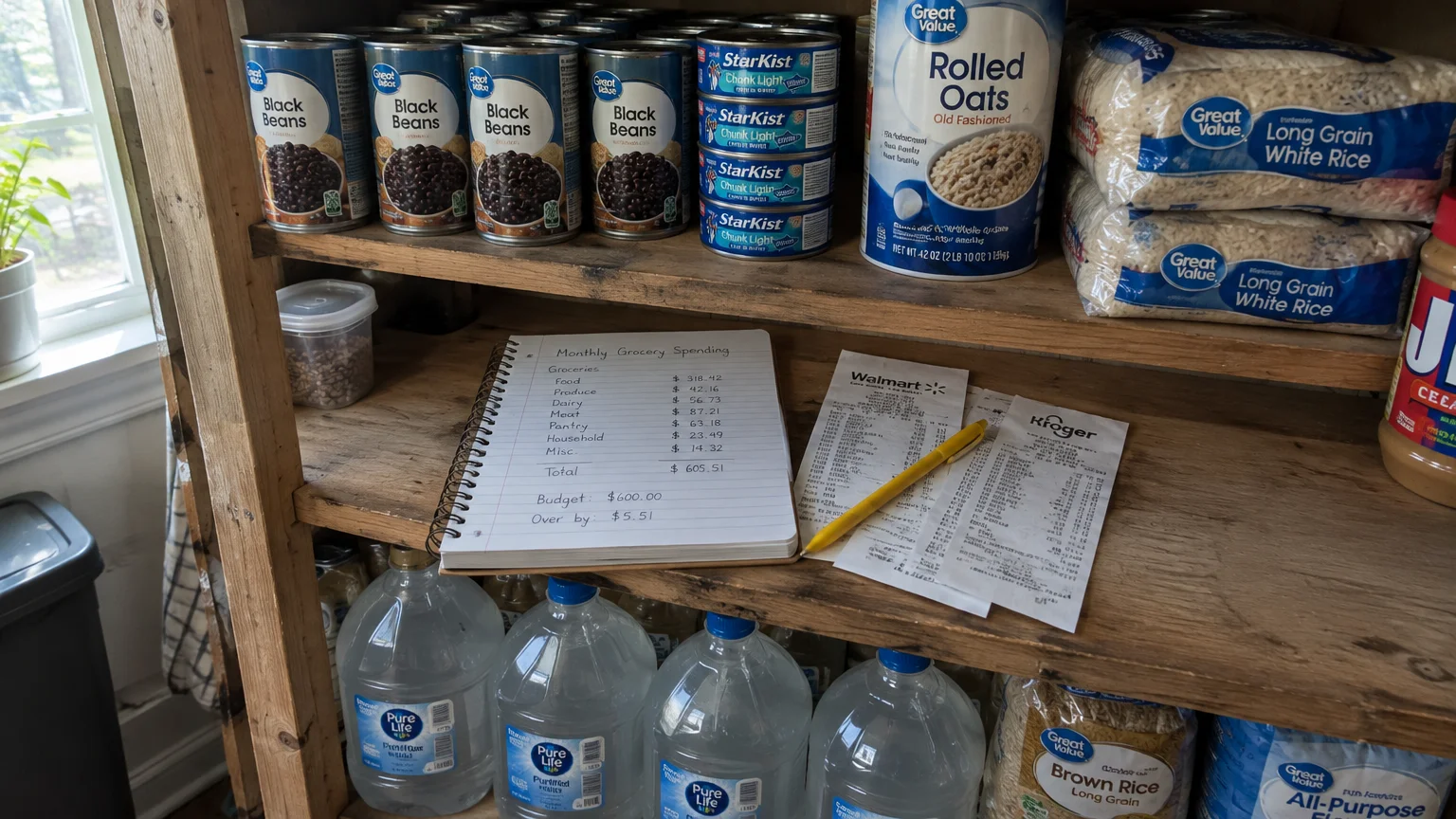
The Financial Reality of War Preparedness
Disaster readiness requires honest financial planning. When catastrophic events occur, your liquid savings dictate your ability to respond, relocate, or purchase lifesaving resources.
According to the Federal Reserve’s 2025 Survey of Household Economics and Decisionmaking, only 63% of American adults can cover a hypothetical $400 emergency using cash or its equivalent. That leaves 37% of the population without basic liquidity.
You can review the full findings directly through the Federal Reserve SHED report, which tracks household economic stability across the United States. Lacking emergency cash severely restricts your evacuation options.
Disaster preparedness also reflects stark income disparities. Data from the Federal Emergency Management Agency shows that roughly half of Americans feel generally prepared for unexpected disasters.
However, historical FEMA data indicates that only 34% of households earning under $35,000 annually have assembled basic emergency supplies. Limited budgets often force families to prioritize immediate bills over future emergency stores.
Fortunately, building basic security does not require thousands of dollars or custom underground bunkers. Consistent, modest allocations of your weekly grocery budget can create a resilient emergency cushion over time.
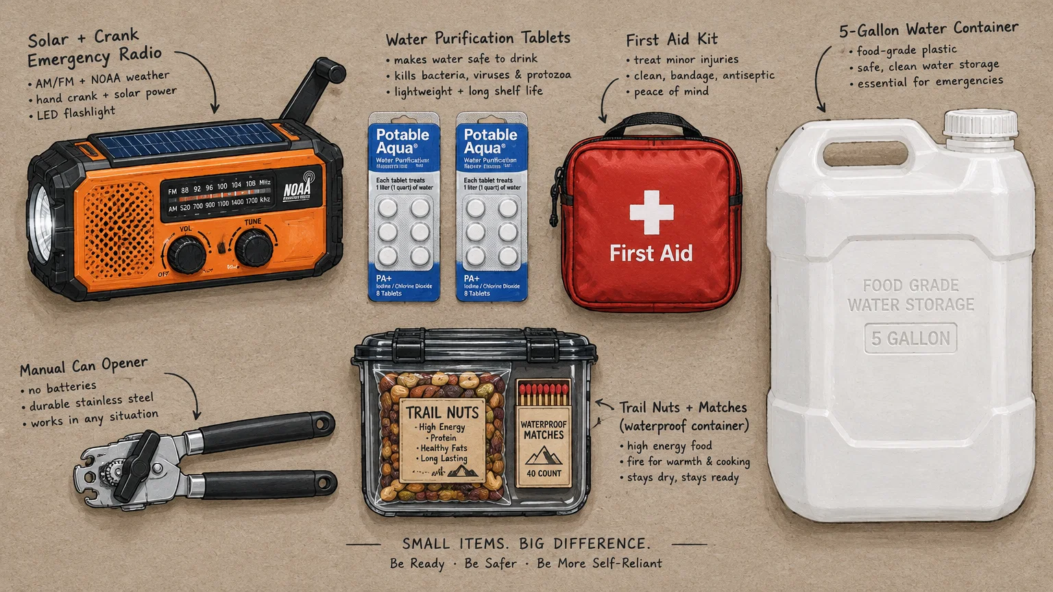
Practical Home Readiness on a Modest Budget
You can establish a solid survival foundation without straining your household finances. The key lies in acquiring shelf-stable essentials incrementally during your normal shopping trips.
Official federal guidelines offer a clear starting point for budget-conscious preppers. According to Ready.gov emergency kit guidelines, every home requires at least one gallon of water per person per day for at least three days.
Water covers both drinking needs and basic sanitation during an outage. Purchasing two gallon jugs each week at your local grocery store builds this critical baseline for under ten dollars.
Federal guidelines also mandate a minimum three-day supply of non-perishable food. Focus on calorie-dense, inexpensive staples such as canned beans, tuna, peanut butter, rolled oats, and white rice.
Do not purchase specialized freeze-dried survival meals if money is tight. Grocery store canned goods last for years, cost a fraction of specialty items, and require no cooking fuel to consume safely.
- Store one gallon of potable water per person per day for drinking, cooking, and hygiene needs.
- Keep a battery-powered or hand-crank NOAA weather radio to monitor official emergency broadcasts when internet access fails.
- Maintain a reserve of liquid cash in small denominations, such as one-, five-, and ten-dollar bills, to buy supplies if card readers stop working.
- Stock basic over-the-counter medications, including pain relievers, fever reducers, antiseptics, and standard first-aid dressings.
- Gather simple illumination tools, such as basic LED headlamps, glow sticks, and spare alkaline batteries, to navigate extended blackouts safely.
Store your cash reserve in a secure, waterproof container at home. During power grid disruptions, point-of-sale terminals and automated teller machines immediately shut down, leaving digital balances inaccessible.
Maintaining small bills ensures merchants can provide change when systems fail. A hundred dollars divided into small bills proves far more useful during a crisis than a single large banknote.
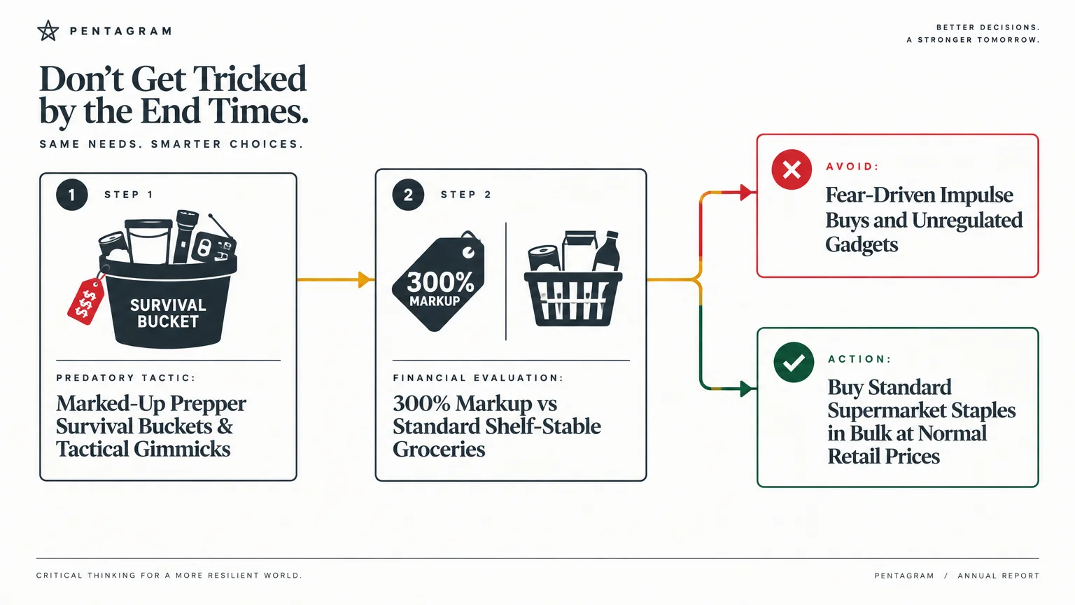
Things to Watch Out For
Preparing for wartime contingencies carries distinct financial and logistical traps. Avoiding common missteps protects your household budget and ensures your supplies actually serve you during an emergency.
The first major trap involves panic-buying overpriced survival gear. Families often waste hundreds of dollars on tactical vests, expensive knives, and boutique survival kits while neglecting basic water storage and shelf-stable food.
Another common mistake is misinterpreting local fallout wind directions. Many people assume they are safe simply because they live in a rural county, ignoring massive downwind plumes from silos hundreds of miles away.
Relying entirely on digital banking represents a severe financial vulnerability during conflict. Cyberattacks on financial backbones can freeze account access instantly, rendering credit cards and payment applications entirely useless.
Finally, falling for the “rural relocation illusion” can devastate your family’s budget. Purchasing remote land without access to fresh water, winter heating, or established local relationships creates financial exhaustion without improving your safety.
When DIY Isn’t Enough
While basic emergency kits fall within everyday home planning, certain crisis preparations require specialized professional expertise. Recognizing your limitations protects your health and personal assets.
Managing complex prescription medical dependencies requires direct coordination with your physician. Individuals relying on insulin, dialysis, or cardiac medications must work with healthcare providers to establish legally compliant, rotating backup supplies.
Evacuation logistics for multi-generational families require professional planning. Navigating travel routes for elderly relatives with severe mobility constraints or infants demands customized medical and transportation solutions.
Securing legal estate documentation and preserving digital assets requires licensed legal counsel. Establishing durable powers of attorney, updating trusts, and creating authenticated physical copies of vital records protects family property rights during displacement.
Purchasing rural property or off-grid homestead infrastructure requires professional land surveys and engineering inspections. Drilling a productive water well and installing off-grid solar systems involve specialized zoning laws and technical certifications that exceed typical DIY skills.
Frequently Asked Questions About War Safety in the US
What is the single safest state if war breaks out?
Northern Maine is widely considered the safest geographic location in the contiguous United States. It sits completely upwind and far north of primary missile silos, lacks strategic military targets, and contains abundant timber and freshwater.
Are major cities automatically targeted during a war?
Major cities with military command centers, key shipping ports, or heavy refinery infrastructure face significant risk. Cities like Washington, D.C., New York City, and Houston represent high-priority targets due to their governmental, financial, and petrochemical importance.
How long must you shelter after a nuclear detonation?
Radioactive fallout decays rapidly following an explosion. According to guidance supported by the Center for Arms Control and Non-Proliferation, sheltering inside a dense, shielded structure for at least 14 days allows dangerous radiation levels to drop to survivable outdoor thresholds.
Can you prepare for a national emergency on a tight budget?
Yes, effective preparedness relies on affordable grocery store staples rather than expensive military gear. Purchasing extra canned goods, standard gallon water jugs, and inexpensive flashlights each week creates a functional 72-hour survival reserve for minimal cost.
Realistic Steps for Everyday Security
Surviving a national conflict or major infrastructure collapse comes down to proactive planning and clear thinking. You do not need extreme wealth or private bunkers to protect your loved ones from severe external shocks.
Begin by taking an honest assessment of your geographical location, nearby military targets, and household emergency savings. Taking small, affordable steps today gives you invaluable security and peace of mind, no matter what tomorrow brings.
The information here is meant for educational purposes. Specific circumstances—including health conditions, finances, location, and goals—may require different approaches. When in doubt, consult a licensed professional or check official sources directly.
Last updated: October 2026. Rules, prices, and details change—verify current information with official sources before acting on it.









Leave a Reply